
Languages of Congo - Kinshasa
All languages of Middle Africa →fluent beta classical · classes by phone with Maya at ranas.ai/maya
Democratic Republic of the Congo Travel Guide — A Country to Understand Before You Ever Plan to Go
I want to be straight with you from the first line: this is not one of my “book the flight” guides. The Democratic Republic of the Congo is the second-largest country in Africa, roughly the size of Western Europe, and it holds some of the most extraordinary geography on the planet — the world’s deepest river, the second-biggest rainforest on Earth after the Amazon, mountain gorillas found nowhere else. It is also, right now, a country under active conflict in its eastern provinces and a formal “do not travel” advisory from the US government. Both things are true at once, and a travel guide that pretends otherwise isn’t doing you any favors. So this guide is built differently: it’s honest about where things stand today, and it’s here so that when the situation changes — and someday it will — you already understand the place. Consider it homework, not an itinerary.
In This Guide
- Overview — A Country the Size of Western Europe
- Two Dry Seasons in One Country
- Best Time to Visit — Season by Season
- Getting There — Airports & Entry
- Getting Around — Rivers, Rails & Roads
- Regions of the DRC
- Culture & People
- A Food Lover’s Guide
- Off the Beaten Path (For When the Time Comes)
- Practical Information
- What It Would Cost
- Frequently Asked Questions
Overview — A Country the Size of Western Europe
The Democratic Republic of the Congo covers about 2,345,409 square kilometres, making it the second-largest country in Africa by area (after Algeria) and the eleventh-largest on Earth. It gained independence from Belgium on 30 June 1960 after decades of colonial rule that were, even by the standards of that era, brutal — the Congo Free State under Belgian King Leopold II is one of the darker chapters in colonial history, and its shadow still shapes how the country’s institutions and borders look today. Since independence the DRC has cycled through a name change (Zaire, 1971–1997), a dictatorship, and two devastating wars in the 1990s and 2000s that killed millions and drew in nearly a dozen neighboring armies, which is part of why the eastern half of the country remains unstable now.
The country borders nine other nations — the Republic of the Congo, the Central African Republic, South Sudan, Uganda, Rwanda, Burundi, Tanzania, Zambia, and Angola (plus Angola’s Cabinda exclave) — along with a short Atlantic coastline. That’s an unusual amount of geographic and political surface area for one country to manage, and it’s a big reason the security picture varies so much from province to province: instability along the eastern borders with Rwanda and Uganda looks nothing like life in Kinshasa or the copper towns of the south.
Geographically, this is one of the great wild places left on the planet. The Congo Basin rainforest is the second-largest contiguous tropical forest on Earth, and the Congo River that drains it is the world’s deepest river, with measured depths around 220 metres, and the third-largest river on the planet by discharge volume, behind only the Amazon and the combined Ganges-Brahmaputra system. Five UNESCO World Heritage Sites protect pockets of this — Virunga, Garamba, Kahuzi-Biéga, Salonga, and the Okapi Wildlife Reserve — and four of the five are currently on the List of World Heritage in Danger, largely because of the same armed-group activity and poaching pressure driving the travel advisories. That overlap — extraordinary natural heritage and extraordinary instability, in the same provinces — is the central fact of the DRC as a place, and it’s why this guide keeps circling back to safety rather than skating past it.
Two Dry Seasons in One Country
Here’s a fact that trips people up: because the DRC straddles the equator, it doesn’t have one wet season and one dry season the way most of tropical Africa does — it effectively has two of each, running in roughly opposite phase north and south of the equatorial line. In the southern half of the country (Kinshasa, Lubumbashi, the Katanga copper belt), the long dry season runs roughly June through September, with a shorter drier spell around December–February; north of the equator, the pattern flips. It’s a genuinely unusual climate signature for a single country and one more reminder of just how much geography this place spans.
Normally, this is also where I’d tell you about the country’s festival calendar and gorilla-trekking high season in Virunga National Park — home to roughly a third of the world’s remaining mountain gorillas in ordinary times. Right now, Virunga sits inside North Kivu province, under an active do-not-travel advisory and largely outside government control, so gorilla trekking there is not something I can respectably recommend. If gorilla trekking is what drew you to this guide, our Rwanda guide covers Volcanoes National Park, which protects the same mountain gorilla population from the other side of the border and is currently operating normally.
Best Time to Visit — Season by Season
June – September · Southern dry season
The most reliably dry stretch across Kinshasa, Kongo Central, and the southern Katanga region — cooler nights, less humidity, easier road travel where roads exist at all. This is also, unhelpfully, hurricane-free but not conflict-free: security conditions in the east don’t track the calendar.
October – May · Wet season(s)
Heavy rain across most of the country, with the equatorial north seeing rain nearly year-round given its position on the Intertropical Convergence Zone. Roads outside major cities can become impassable, and river transport — already the backbone of Congolese logistics — becomes the more reliable option in many regions.
Right now · Advisory-driven, not calendar-driven
Given the current Level 4 advisory and active conflict in the east, “best time to visit” honestly isn’t a seasonal question at the moment — it’s a policy question that depends on when conditions in North and South Kivu stabilize and advisories are lifted or downgraded. Check travel.state.gov and gov.uk/foreign-travel-advice for current status before making any plans.
Getting There — Airports & Entry
N’djili International Airport (FIH), about 25 kilometres southeast of central Kinshasa, is the country’s main international gateway and the largest of DRC’s five international airports. Brussels Airlines, Air France, Ethiopian Airlines, Kenya Airways, Qatar Airways, Royal Air Maroc, and TAAG Angola Airlines all connect Kinshasa to their respective hubs, alongside the national carriers Air Congo and Congo Airways; a newer international terminal, opened in 2015, has capacity for roughly one million passengers a year.
Every foreign visitor needs a visa arranged in advance through a DRC embassy or consulate — there is no visa-on-arrival or visa-free tourist entry for US, UK, EU, or Canadian passport holders. Standard tourist applications typically require a notarized letter of invitation, proof of onward travel and accommodation, and a valid yellow fever vaccination certificate, and DRC border officials do check for the latter. Given the current security and consular situation, requirements and processing can change with little notice, so confirm details directly with a DRC embassy and your own government’s travel advisory before applying.
Getting Around — Rivers, Rails & Roads
The Congo River and its tributaries have been the country’s real highway system for over a century, and they still are: paved road coverage is thin relative to the country’s size, and river barges and ferries move people and goods between river towns where roads don’t reach or don’t survive the wet season. Historic rail lines connect some regions — the old Matadi–Kinshasa line follows the river’s navigable gap around the Inga rapids, and Matadi remains the country’s largest port, handling the bulk of DRC’s seaborne trade.
Domestic flights connect Kinshasa to provincial capitals like Lubumbashi, Goma, and Kisangani, and are often the only practical way to cover the country’s vast distances — but note that the UK FCDO specifically flags Kisangani’s Bangoka International Airport for repeated drone-attack risk under current conditions, a reminder that “getting around” here is inseparable from the security picture in each province. In ordinary times, self-driving isn’t something most visitors attempt outside Kinshasa; hired drivers and organized transport are the norm.
Regions of the DRC
I’m describing these regions for context and geography, not as a menu of destinations to book this year. Where the current advisory situation directly affects an area, I’ve said so plainly.
Kinshasa & Kongo Central
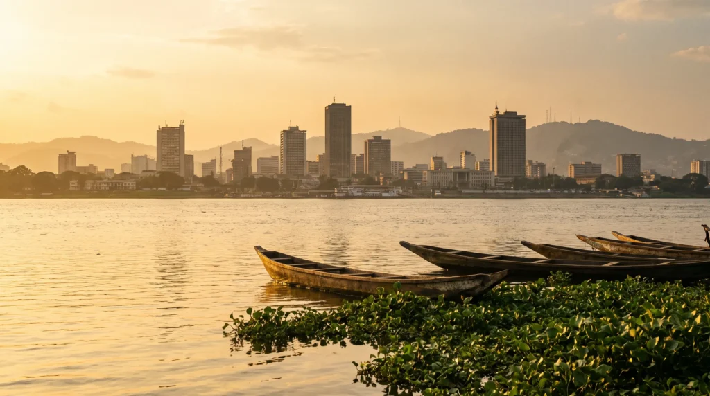
Kinshasa is the capital, largest city, and economic center, with a city-province population that passed 18.5 million in 2021 estimates. Across the Congo River sits Brazzaville, capital of the separate Republic of the Congo — the two form what’s often described as the world’s closest pair of national capitals, separated by roughly four kilometres of unbridged river. Even here, the UK FCDO advises against all but essential travel to specific districts south of the N’djili airport road and along the N1 toward Kenge, so this is not a blanket “Kinshasa is fine” situation — it requires current, granular guidance. West of the capital, Kongo Central province holds the Atlantic coastline, the port city of Matadi, and Boma, which served as the colonial capital of the Congo Free State and Belgian Congo from 1886 until the seat moved to Kinshasa (then Léopoldville) in 1923.
Katanga (Lubumbashi & the copper belt)
The southeastern mining region around Lubumbashi, the country’s second city, sits atop some of the richest copper and cobalt deposits on Earth — the DRC supplies a large share of the world’s cobalt, the mineral behind most lithium-ion batteries. It’s historically been more insulated from the eastern conflict than the Kivus, though the FCDO and State Department both flag neighboring Tanganyika and Haut-Lomami provinces for frequent violent crime and armed-group clashes, so “insulated” is relative, not a clearance to visit freely.
The Congo Basin rainforest & Salonga
Central DRC holds vast stretches of the Congo Basin rainforest, the second-largest tropical forest on Earth, including Salonga National Park — at roughly 33,000 square kilometres, one of Africa’s largest protected rainforest reserves and, notably, the one DRC World Heritage site that was removed from the endangered list in 2021 after conservation gains. It remains almost entirely without tourism infrastructure — accessible mainly by river, and a conservation project first, not a destination.
Eastern DRC — North Kivu, South Kivu & Ituri
This is the DRC of Virunga’s volcanoes and mountain gorillas, Lake Kivu’s shoreline towns, and — under normal conditions — some of the most dramatic landscapes in the country. It is also, right now, the epicenter of the crisis: the M23 armed group controls the major cities of Goma and Bukavu, missiles and armed drones have reportedly been used in the fighting, and Ituri province is simultaneously dealing with an Ebola outbreak. Both the US and UK governments advise against all travel here, full stop. I’m including it in this guide because it’s geographically central to understanding the country — not as a place to plan around visiting at present.
Culture & People
French is the official language, a legacy of Belgian colonial rule, but it functions mainly as the language of government, education, and inter-ethnic communication rather than most people’s first language at home. Four national languages — Lingala, Kikongo, Swahili, and Tshiluba — carry far more daily use, each dominant in different regions: Lingala in and around Kinshasa and along the river, Swahili across the east, Tshiluba in the central Kasai region, Kikongo in the west. The country is home to more than 200 ethnic groups and correspondingly deep musical and artistic traditions — Congolese rumba, built on Cuban son and local rhythms in the mid-20th century, became one of the most influential popular music styles across the entire African continent, and its DNA runs through soukous, ndombolo, and much of what plays on radios from Lagos to Nairobi.
It’s worth sitting with the fact that this cultural richness developed alongside, and partly in response to, one of the most violent colonial histories on the continent, followed by decades of instability since independence. Congolese art, music, and literature carry that history directly — this isn’t background trivia, it’s part of what makes Congolese culture distinct even from its immediate neighbors.
A Food Lover’s Guide
Congolese cuisine centers on fufu (a dense, pounded starch, usually cassava or a cassava-cornmeal blend) and chikwangue (fermented cassava bread, often wrapped in leaves), served alongside stews built on cassava leaves (saka saka or pondu), palm oil, peanuts, and freshwater fish from the Congo River system. Grilled or braised goat and chicken show up at celebrations; in river towns, fish stew is closer to the daily default than an occasion dish. Beer culture runs deep here too — Primus and Skol are the dominant national brands, brewed domestically for generations, and a cold one alongside grilled fish is about as close to a national pastime as this country has.
Kinshasa’s food scene, in ordinary times, reflects the city’s role as a genuine megacity: French-influenced fine dining sits blocks from street-food stalls selling grilled brochettes and fried plantain, with a strong Belgian-colonial imprint still visible in bakeries and pastry shops decades after independence.
Off the Beaten Path (For When the Time Comes)
Lola ya Bonobo, near Kinshasa
The world’s only sanctuary dedicated to orphaned bonobos, founded by Claudine André in 1994 and located in roughly 30 hectares of primary forest near the Kimwenza suburb south of Kinshasa. It’s home to around 60 rescued bonobos — many arriving as infants after the illegal bushmeat and pet trade kills their mothers — and some rehabilitated bonobos have since been reintroduced to a protected rainforest site. Of everything in this guide, this is the site closest to a going concern under current conditions, given its proximity to the relatively more stable capital — though it sits within reach of the advisory zones flagged around Kinshasa, so current guidance still applies.
Boma & the Atlantic coast
DRC’s brief stretch of Atlantic coastline and the historic port town of Boma — colonial capital of the Congo Free State and Belgian Congo from 1886 to 1923 — hold a very different, quieter version of the country’s history than the interior.
Inga Falls
Downstream from Kinshasa, the Congo River drops through the Inga rapids in a stretch that holds an outsized share of the world’s hydropower potential — the Congo Basin alone accounts for roughly 13% of global hydroelectric potential, and the existing Inga I and II dams already generate 1,776 megawatts, a fraction of what a long-proposed “Grand Inga” scheme (up to 34,500 MW) could one day produce. It’s an engineering and geography story more than a tourist site, but a genuinely staggering one.
Practical Information
Safety, first and always. Re-read the advisory box at the top of this guide. The US rates DRC Level 4: Do Not Travel; the UK advises against all travel to the eastern provinces and against nonessential travel to specific areas near Kinshasa and Kisangani. Both governments note severely limited ability to assist travelers outside Kinshasa. Check current advisories immediately before any trip — conditions can change quickly in either direction.
Health. A CDC Level 3 travel health notice is in effect for an Ebola outbreak (Bundibugyo virus) concentrated in Ituri, North Kivu, and South Kivu provinces, with CDC recommending against nonessential travel to those specific areas and 21-day symptom monitoring for anyone who has been in affected regions. A valid yellow fever vaccination is generally required for entry, and malaria precautions are essential countrywide. Given the fast-moving health situation, check the CDC’s DRC traveler page directly before any trip, regardless of destination within the country.
Money. The Congolese franc (CDF) floats against major currencies and has depreciated substantially over the past decade — it traded around 2,800 CDF to the US dollar as of April 2024, and rates move, so check a current source rather than relying on any fixed number. Card payment infrastructure is limited outside a handful of Kinshasa hotels and businesses.
Visas & entry. Advance visas are required for essentially all foreign visitors; there’s no visa-on-arrival for tourism. Given how quickly consular and entry policies are shifting alongside the security and health situation, treat any visa information — including this guide’s — as a starting point to confirm directly with a DRC embassy, not a final answer.
What It Would Cost
I’m not publishing a per-day budget breakdown for the Democratic Republic of the Congo right now, and that’s deliberate. Under a Level 4 Do Not Travel advisory, the honest answer to “what should I budget” is that this isn’t currently a trip to be budgeting for — the relevant costs are the ones tied to whether travel is advisable at all, not hotel tiers or meal prices. What is worth knowing: this is not a budget destination even in calmer times — limited tourism infrastructure, costly domestic flights, and mandatory advance visas all push costs up relative to comparably-sized African neighbors. If you’re pricing out Congo Basin rainforest or mountain gorilla experiences specifically, our Rwanda and Uganda guides cover real, bookable budget ranges for gorilla trekking permits and lodges on the accessible side of those same mountain ranges.
Planning — What I’d Actually Suggest Right Now
If DRC is on your radar because of the mountain gorillas, the Congo Basin rainforest, or Lake Kivu’s landscapes, the most responsible near-term move is to look at the countries sharing those same ecosystems from the accessible side of the border. Our Rwanda guide covers Volcanoes National Park’s gorilla trekking directly; our Uganda guide covers Bwindi Impenetrable Forest’s gorillas and the Rwenzori Mountains; our Tanzania guide and Zambia guide cover the wider East and Southern African landscapes that border DRC without its current advisory status. Keep this guide bookmarked for the geography and context — and keep checking travel.state.gov and gov.uk/foreign-travel-advice for whenever the picture in the DRC itself changes.
Frequently Asked Questions
Is it safe to travel to the Democratic Republic of the Congo right now?
No — as of this writing, the US State Department rates DRC at Level 4: Do Not Travel, its highest advisory level, and the UK FCDO advises against all travel to the eastern provinces and against nonessential travel to specific areas near Kinshasa and Kisangani. Check both sources directly and current conditions before making any decision.
Can I still visit the mountain gorillas in Virunga National Park?
Virunga sits within North Kivu province, which is under an active do-not-travel advisory and largely outside government control amid the M23 conflict. The same mountain gorilla population is trekkable from Rwanda’s Volcanoes National Park or Uganda’s Bwindi Impenetrable Forest, both currently operating.
Do I need a visa to visit DRC?
Yes — a visa arranged in advance through a DRC embassy or consulate is required for essentially all foreign nationalities, including US, UK, EU, and Canadian passport holders. There is no visa-free or visa-on-arrival tourist entry. Requirements can change; confirm directly with a DRC embassy before applying.
What’s causing the current crisis in eastern DRC?
The armed group M23 has taken control of the major eastern cities of Goma and Bukavu in fighting against Congolese government forces, with reports of missiles and armed drones being used in the conflict — on top of a separate Ebola outbreak centered in Ituri province that has triggered its own international health emergency response.
Is any part of the country considered lower-risk?
Parts of Kinshasa and the southern Katanga copper belt have generally seen less direct conflict than the eastern Kivus and Ituri, but both the US and UK advisories still flag specific districts and nearby provinces for serious risk, and neither government treats any part of the country as fully clear right now. This is not a green light for any particular area — check current, granular advisory guidance rather than general geography.
When will it be safe to visit the DRC again?
There’s no honest way to predict that from here. The most useful thing you can do is keep watching official advisory pages rather than travel blogs or social media for the actual status, since conditions in a conflict zone can shift quickly in either direction.
A Country Worth Understanding — Even Before You Can Visit
The Democratic Republic of the Congo holds the world’s deepest river, one of its largest rainforests, and a cultural depth that has shaped music and art across an entire continent — alongside a present-day crisis that means this isn’t, for now, a trip to plan. Both things belong in the same sentence. Bookmark this guide, keep an eye on official advisories, and when the day comes that the Kivus are stable and the advisories lift, the DRC will still be one of the most extraordinary places on the map.
Explore More
- Rwanda Travel Guide — Volcanoes National Park gorilla trekking, the accessible side of the same mountains
- Uganda Travel Guide — Bwindi’s gorillas, the Rwenzori Mountains, and Lake Victoria’s shores
- Tanzania Travel Guide — the wider East African landscape bordering DRC’s east
- Zambia Travel Guide — southern neighbor across the Katanga copper belt border
How this guide was built
Published . Given the ongoing crisis, this guide was built with safety as the first priority: the current US State Department and UK FCDO advisories for the Democratic Republic of the Congo, the CDC’s Level 3 Ebola travel health notice, Wikipedia entity pages for the country, Kinshasa, the Congo River, the Congolese franc, Boma, Lola ya Bonobo, and the UNESCO World Heritage Sites list, plus the N’djili International Airport page. All numeric and checkable claims carry inline citations to these sources. Where a fact could not be verified from an authoritative source, it was described qualitatively rather than estimated.
Sources cited on this page
- US State Department — DRC Travel Advisory
- UK FCDO — DRC Travel Advice
- US CDC — Ebola Travel Health Notice, DRC
- Wikipedia — Democratic Republic of the Congo
- Wikipedia — List of World Heritage Sites in the DRC
- Wikipedia — N’djili International Airport
- Wikipedia — Kinshasa
- Wikipedia — Congo River
- Wikipedia — Congolese Franc
- Wikipedia — Boma
- Wikipedia — Lola ya Bonobo
More country guides you might like
Plan your trip to Democratic Republic of the Congo
The booking tools we use ourselves. FFU may earn a commission at no extra cost to you.
Plan & book your trip to Democratic Republic of the Congo
Booking through these searches supports our guides at no extra cost to you.
Curated multi-day tours to Democratic Republic of the Congo — Exoticca →